毛乌素沙地沙丘干沙层水分特征初步研究

文章编号:1001-4675(2006)01-0089-04
毛乌素沙地沙丘干沙层水分特征初步研究
*
王
志,王
蕾,刘连友,郑秋红
(北京师范大学资源学院中国沙漠研究中心环境演变与自然灾害教育部重点实验室,北京100875)
摘
要:干沙层对抑制蒸发保护沙漠地区的生态水具有重要作用。在毛乌素沙地进行水分实验观测表明,当地干
沙层的厚度在12~20cm ,干沙层内部的平均含水量在0.42%~0.54%,且水分由地表向下边界呈指数增加,R 2在0.88~0.99之间。干沙层的厚度变化与所处沙丘的位置、
沙面活动程度以及有无植被覆盖等有关。降雨对近地表干沙层的消失和产生有重要影响,近地表干沙层的发育是水分下渗、蒸发和水汽凝结共同作用的结果。关键词:干沙层;水分;降雨;下渗;蒸发;凝结;毛乌素沙地中图分类号:P931.3
文献标识码:A
沙漠地区蒸发强烈,地表存在的极其干燥的
沙层被称为干沙层
〔1〕
,干沙层的形成与地表蒸发有着紧密的关系〔2~4〕
。干沙层的形成可以降低蒸发速率
〔5,6〕
,他对于生态水的保护具有重要的作用。干沙层的厚度随时间和空间的变化而不同〔7〕
,有不同的确定方法
〔2,8~12〕
。对干沙层特性的研究表明,土壤内水分的汽化发生在干湿沙层边界〔3,4〕
,当辐
射输入变化时干沙层内部也有短时的汽化和凝结
发生〔13~15〕,同时干沙层的发展变化与当地地温变化具有相似的周期性〔10〕。Kobayashi 等〔16,17〕根据
扩散理论建立了等温和非等温模型,通过地温、含
水率和干沙层厚度来计算地表蒸发
〔5,18〕
。干沙层的作用机制复杂,目前的研究主要集中在数值模拟和实验室实验上,对于自然条件下近地表干沙层的水分变化研究相对较少。本文观测了毛乌素沙地沙丘近地表干沙层水分剖面变化,并在自然条件下通过对降雨及雨后近地表水分变化的监测,来分析干沙层消失和产生过程。
1研究区与实验方法
1.1
研究区概况
研究区位于陕西省靖边县北部风沙区,地理坐标为108o50'54"~108o58'00"E ,37o38'42"~37o42'42"N ,
处于毛乌素沙地南缘,属半干旱地区。该区年降水量395.4mm ,且主要集中在7~9月份,占全年降水量的80%。年平均气温7.8℃,昼夜温差大,蒸发强烈。年蒸发量2361.6mm ,年日照时
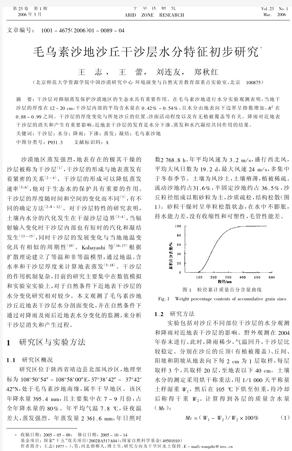
数2768.8h 。年平均风速为3.2m /s ,盛行西北风,平均大风日数为19.2d ,最大风速24m /s ,多集中于冬春季节。土壤为风沙土,土壤瘠薄,植被稀疏。流动沙地约占31.6%,半固定沙地约占36.5%,沙丘粒径组成以粗砂粒为主,沙质疏松,结构松散(图1)
。砂粒干燥时呈单粒松散状态,在水中不膨胀,持水能力差,没有收缩性和可塑性,毛管性能差。
图1
粒径累计质量百分含量曲线
Fig.1
Weight percentage contents of accumulative grain sizes
1.2
研究方法
实验包括对沙丘不同部位干沙层的水分观测和降雨对近地表干沙层的影响。野外观测在2004年春末进行,此时,降雨稀少,气温回升,干沙层比较稳定。分别在沙丘的丘顶(有植被覆盖)、丘间、
阳坡和阴坡从地表向下每2cm 为1层取样,每层取样3个,共取样20层,至地表以下40cm 。土壤水分的测定采用烘干称重法,用1/1000天平称量土样湿重W 1,然后在105℃下烘至恒重,待冷却后称得干重W 2。计算得到各层的质量含水量(Mc ):
Mc =
(W 1-W 2)/W 2×100%(1)
第23卷第1期2006年3月
干旱区研究ARID ZONE RESEARCH
Vol.23No.1Mar.2006
*收稿日期:2005-05-09;修订日期:2005-10-14
基金项目:国家“十五”攻关项目(2002BA517A04);国家自然科学基金(49501010)作者简介:王志(1977-),男,河北邯郸人,博士生,研究方向为干旱区水土保持.E -mail :wangzhi @
https://www.wendangku.net/doc/d218974790.html,
降雨对近地表干沙层水分的影响是在平沙地上进行的。降雨量用雨量筒(F=20cm)量测。4月30日至5月2日,为小阵雨天气,4月30日19时至5月1日7时降雨1.73mm,5月1日12时至2日7时降雨量最多,为5.14mm,2日9时至19时降雨0.67mm,累计3d降雨量为7.5mm。继第1次降雨之后,跟踪测定了沙地表层土壤水分的变化过程,采样时间分别是5月1~2日每天早上(8时)观察1次,5月3~6日每天早(6时)晚(20时)各观测1次。土壤水分的取样方法和计算方法与上相同。同期观测了当地8:00,14:00和20:00时的气温。并埋设曲管地温计、地表温度计观测地表以及地下5,10,15,20cm地温。观测期间为静、微风天气。
2结果与讨论
2.1干沙层水分剖面特征
由于沙质土干湿沙层之间导水率具有显著差别,干沙层的厚度可以通过土壤水分剖面变化的转折点进行划分〔10〕。根据观测,在丘顶、阳坡和阴坡这一水分转折十分明显,笔者将其作为干沙层与湿沙层的界线(图2)。沙丘的不同部位,干沙层的厚度不同。丘顶厚度为10cm,沙丘的阳坡厚度约为18cm,阴坡约为12cm,在干沙层的边界以下,湿沙的土壤水分含量明显提高,并相对稳定在一定的水分值(3%)范围内。这与Westcot&Wierenga利用Berino的细砂做的水分剖面很相似〔19〕。而丘底由于具有蓄积水分的作用,其水分条件要比沙丘其他部位好,水分变化连续,干湿层界线不明显。一般说来,干沙层的厚度丘顶高于丘底,阳坡高于阴坡,这与沙丘不同位置的沙面活动程度有关〔7〕。通过对表层0~5cm沙粒的机械组成分析,沙丘阳坡、阴坡、丘顶和丘底的平均F值分别为2.28,2.33,2.17和2.38。沙丘表面因风力分选所决定的物质组成对干沙层厚度影响很大。因沙丘部位不同,物质组成不同,多导致毛管作用的差异,进而影响干沙层厚度。本观测结果中丘顶干沙层厚度并不是最高的,这主要是因为丘顶有沙柳等植物覆盖的结果。干沙层内平均含水量在0.42%~0.54%,表层含水量在0.11%~0.26%,下边界的含水量在0. 94%~1.16%。各部位干沙层内部的水分均由地表向其下边界呈指数增加,R2在0.88~0.99之间。丘顶:Mc=0.0886e0.2496x R2=0.96(2)丘底:Mc=0.0639e0.2367x R2=0.93(3)阳坡:Mc=0.1485e0.09x R2=0.87(4)阴坡:Mc=0.1603e0.1799x R2=0.99(5)式中,x为土壤深度(cm),Mc为含水量。
图2近地表沙层土壤水分分布
Fig.2Distribution of topsoil moisture content
2.2降雨对干沙层水分变化的影响
降雨对近地表沙层的水分有重要的影响。气温在降雨期间降低,1日午后气温15℃,2日7.3℃,之后天气晴朗气温逐日升高,3日11.2℃,4日16.1℃,5日25.4℃,雨后3d的地温变化日较差也不断增大,3~5日午后地表与地下20cm处的温差分别达到15.5,27.5℃和32.3℃,有利于地表水分的蒸发(图3)。
图3地温与气温图
Fig.3Ground temperature and air temperature
图5为观测区土壤含水量变化,可以清楚地看出,干沙层由于降雨逐渐被浸润消失,下渗峰面随时间向下移动,随后从地表又逐渐形成干沙层的整个过程。在观测过程中没有地表径流产生,也没有发现指流现象〔20,21〕。由地表向下至20cm各层水
09干旱区研究23卷
分均出现一个峰值,且峰值出现的时间顺序随深度变化,同时峰也随深度加深而逐渐变小(图4),这
与Philip 的渗透方程是一致的
〔22〕
。5月1日,降雨1.73mm 时采样,0~2cm 水分值是4.93%,其下2~4cm 的水分值降到0.20%,
只有表层0~2cm 被降雨浸润;在5月2日又降雨5.10mm 后,水分下渗深度达8cm ,0~8cm 各层水分含量均在5.14%以上,而8~10cm 水分只有1.12%。0~6cm 各层的水分峰值在2日相继出现。3~4日,8~14cm 各层的含水量峰值先后出现,18~20cm 层的峰值亦在4日晚出现,但峰已不如上层明显。25cm 深度以下在整个观测时段水分基本保持稳定,无峰值出现,由于雨量小,基本不受这次降雨的影响。水分下渗的同时,在蒸发的作用下,地表从3日开始出现干沙层(图4),0~2cm 水分已明显下降,含量为0.98%;此后,随着气温的升高,蒸发作用越来越强烈,5日,2~4cm 亦形成干沙,其他各层水分均有明显下降,沙地表层整体进入干化过程。观测结果表明,近地表干沙层内部水分受地温影响明显,在0~5cm 的范围内,地温日较差很大,夜间地温明显下降(图3),干沙层内部发生了水汽凝结,6日晨0~4cm 干沙层水分值又有所回升(图4),与
Yamanaka 等
〔13,14〕
的数值模拟结果一致。因此,雨后近地表干沙层的形成是水分的下渗、蒸发和凝结共同作用的结果。
图4
各层含水量曲线图
Fig.4
Soil moisture content at different depths
图5降雨对近地表沙层水分的影响
Fig.5
Effect of rainfall on the topsoil moisture content
3结论
毛乌素沙地春季地表极其干燥,存在着明显的干沙层。干沙层的厚度在12~20cm 之间,干沙层内部的平均含水量在0.42%~0.54%,且水分由地表向下边界呈指数增加,R 2在0.88~0.99。干沙层的厚度变化与所处沙丘的位置、沙面活动程度以及有无植被覆盖等有关。
降雨对近地表沙层的水分有重要的影响,降雨水分下渗导致了干沙层的消失,在雨后一段时期内,由地表向下依次出现水分峰值,并且各层峰值大小逐层递减;蒸发作用下使干沙层又重新产生,且不断增厚;而在日内伴随地温周期性变化,夜间产生的水汽凝结作用使干沙层内部的水分提高,清晨干沙层的厚度小于傍晚。因此,近地表干沙层的发育是水分下渗、蒸发和凝结共同作用的结果。参考文献(References ):
〔1〕Mastsuda A ,Yano T ,Cho T.Studies on the micrometeorology in the
sand dune (1)on the radiation balance 〔J 〕.Journal of Agricultural Meteorology ,1972,28:11-17.
〔2〕Fritton D D ,Kirkham D ,Shaw R H.Soil water chloride redistribu-tion under various evaporation potentials 〔J 〕.Soil Science Society of America Proceedings ,1967,31:599-603.
〔3〕Hillel D.Soil and Water :Physical Principles and Processes 〔M 〕.
New York :Academic Press ,1971.288.
〔4〕Campbell G S.Soil Physics with Basic :Transport Models for Soil-Plant System
〔M 〕.New York :Elsevier ,1985.150.〔5〕李品芳,李保国.毛乌素沙地水分蒸发和草地蒸散特征的比
较研究〔J 〕.水利学报,2000(3):24-28.〔Li Pinfang ,Li Baoguo.Study on some characteristics of evaporation of sand dune and evapotranspiration of grassland in Mu Us desert 〔J 〕.Journal of Hydraulic Engineering ,2000(3):24-28.〕
〔6〕吕贻忠,杨佩国.荒漠结皮对土壤水分状况的影响〔J 〕.干旱
区资源与环境,2004,18(2):76-79.〔Lu Yizhong ,Yang Peiguo.The effects of desert crust on the character of soil water 〔J 〕.Journal of Arid Land Resources and Environment ,2004,
18(2):76-79.〕〔7〕兰州沙漠研究所沙坡头沙漠科学研究站.包兰铁路沙坡头段
固沙原理与措施〔M 〕.银川:宁夏人民出版社,1991.22-31.〔Shapotou Desert Science Station ,Institue of Desert Research ,CAS.Principle and Method on Sand-fixing at the Shapotou Part ,Baotou-Lanzhou Railway 〔M 〕.Yinchuan :Ningxia People Press ,1991.22-31.〕
〔8〕
Fritton D D ,Kirkham D ,Shaw R H.Soil water evaporation ,isothermal diffusion ,and heat and water transfer 〔J 〕.Soil Science Society of America Proceedings ,1970,34:183-189.
〔9〕Matsuda J F ,Noilhan https://www.wendangku.net/doc/d218974790.html,parative study of various formulations of
evaporation from bare soil using in situ data 〔J 〕.Journal of Applied Meteorology ,1991,30:1354-1365.
〔10〕冯起.半湿润沙地干沙层特性的初步研究〔J 〕.干旱区研究,
1994,11(1):24-27.
〔Feng Qi.Preliminary study on the dry sand 1
91期王
志等:
毛乌素沙地沙丘干沙层水分特征初步研究
layer of sandy land in semi-humid region〔J〕.Arid Zone Research,1994,11(1):24-27.〕
〔11〕Shurbaji A-R M,Phillips F M,Campbell A R,et al.Application of
a numerical model for simulating water flow,isotope transport,and
heat transfer in the unsaturated zone〔J〕.Journal of Hydrology,1995,171:143-163.
〔12〕Shurbaji A-R M,Phillips F M.A numerical model for the movement of H2O,H218O,and2HHO in the unsaturated zone〔J〕.Journal of
Hydrology,1995,171:125-143.
〔13〕Yamanaka T,Takeda A,Shimada J.Evaporation beneath the soil surface:some observational evidence and numerical experiments〔J〕.
Hydrological Processes,1998,12:2193-2203.
〔14〕Yamanaka T,Yonetani T.Dynamics of the evaporation zone in dry sandy soils〔J〕.Journal of Hydrology,1999,217:135-148.〔15〕曹文炳,万力,周训,等.西北地区沙丘凝结水形成机制及对生态环境影响初步探讨〔J〕.水文地质工程地质,2003(2):6
-10.〔Cao Wenbing,Wan Li,Zhou Xun,et al.A preliminary
study of the formation mechanism of condensation water and its effects
on the ecological environment in northwest China〔J〕.Hydrology and
Engineering Geology,2003(2):6-10.〕
〔16〕Kobayashi T,Matsuda A,Kamichika M.Studies of the dry surface
layer in a sand dune field(2)effects of soil temperature gradients on
the water content profiles in the dry surface layer〔J〕.Journal of A-
gricultural Meteorology,1987,43(2):121-126.
〔17〕Kobayashi T,Matsuda A,Kamichika M.A simple method for esti-mating the rate of evaporation from a dry sand surface〔J〕.Journal of
Agricultural Meteorology,1989,44(4):269-274.
〔18〕Li Q,Kobayashi T,Motada Y,et al.Evaporation characteristics of the dune sand in the Mu Su Shamo Desert,China〔J〕.Journal of A-
gricultural Meteorology,1989,44(4):301-304.
〔19〕Westcot D W,Wierenga P J.Transfer of heat by conduction and va-por movement in a closed soil system〔J〕.Soil Science Society of
America Proceedings,1974,38:9-14.
〔20〕Hendrickx J M H,Yao T.Prediction of wetting front stability in dry field soils using soil and precipitation data〔J〕.Geoderma,1996,70:265-280.
〔21〕Arbel Y,Yair A,Oz S.Effect of topography and water repellent layer on the non-uniform development of planted trees in a sandy arid area 〔J〕.Journal of Arid Environments,2005,60:67-81.
〔22〕L D贝弗尔,W H加德纳,W R加德纳.土壤物理学〔M〕.北京:农业出版社,1983.〔Baver L D,Gardner W H,Gardner W R.
Soil Physics〔M〕.Beijing:Agriculture Press,1983.〕
Preliminary Study on Soil Moisture Content in Dried Layer of
Sand Dunes in the Mu Us Sandland
WANG Zhi,WANG Lei,LIU Lian-you,ZHENG Qiu-hong
(China Center of Desert Research,College of Resources Science and Technology,Beijing Normal University;
Key Laboratory of Environmental Evolution and Natural Disaster Research,Ministry of Education,Beijing100875,China)
Abstract:The study area(37o38'42"~37o42'42"N,108o50'54"~108o58'00"E)is located in the southern marginal zone of the Mu Us Sandland in the northern part of Jingbian County,Shaanxi Province.In the area it belongs to the semiarid climate,the annual precipitation is395.4mm,the rainfall occurs mainly during the period from July to September and its proportion occupies80%of the annual precipitation,and the annual evaporation is as high as2 361.6mm;the annual temperature is7.8℃,and the diurnal-nocturnal temperature difference is high;the annual sunshine duration is2768.8hours,strong winds occur frequently,especially in winter and spring,the annual days of occurring strong winds are19.2days,the annual average and maximum wind speeds are3.2m/s24.0m/s respec-tively,and the direction of prevailing wind is NW.In the study area soil is dominated by aeolian sandy soil,the soil fertility is poor,the natural vegetation is sparse,and the areas of mobile-dune regions and semi-fixed sandlands occupy 31.6%and36.5%respectively.Dried sand layer plays an important role in restricting evaporation and conserving e-cological water in deserts.The experiment in the Mu Us Sandland reveals that the thickness of dried sand layer varies in a range of12~20cm,the soil moisture content in the dries sand layer varies in a range of0.42%~0.54%and is increased downward in an exponential way,and R2varies in a range of0.88~0.99.The thickness of dried sand layer is related to the dune location,mobile degree of sand surface,vegetation types and coverage,etc.Rainfall af-fects significantly the soil moisture content,the dried sand layer disappears and the peak values of soil moisture content occur in succession and reduce downward after rainfall.Evaporation brings about a reoccurrence of the dried sand lay-er.
Key words:dried sand layer;soil moisture content;rainfall;downward infiltration;evaporation;condensation;the Mu Su Sandland.
29干旱区研究23卷
- 每日一题500毛乌素沙地(简)
- 实用类文本毛乌素沙地治理阅读练习及答案
- 毛乌素沙地气候变化及其对植被覆盖的影响
- 浅谈毛乌素沙漠地带植被恢复技术
- 毛乌素沙地典型地段沙漠化土地格局分析
- 世界最强沙漠暴雨中心—毛乌素沙地
- 毛乌素地区沙漠化现状分析
- 毛乌素沙地,澳洲沙漠与巴丹吉林沙漠概况
- 毛乌素沙地缘起唐代
- 高考文综地理区域地理 毛乌素沙地系列专题复习
- 毛乌素沙漠政府治理方案剖析
- 毛乌素沙地景观格局变化研究
- 毛乌素沙漠
- 毛乌素沙地变化监测
- 毛乌素沙地概况
- 毛乌素沙漠 治理奇迹
- 穿越毛乌素沙漠感想与建议
- 毛乌素沙漠—世界沙漠暴雨中心
- 毛乌素沙地,澳洲沙漠与巴丹吉林沙漠概况
- 高考文综地理区域地理毛乌素沙地系列专题复习